Posted: August 8, 2014
Ecosystem Diversity
21 places demonstrating extraordinary natural and ecological diversity of the Ottawa River.
By Dan Brunton
It is more than intellectual interest that has inspired scientists and researchers of many stripes to study and record the extraordinary natural and ecological diversity of the Ottawa River. There are about twenty sites described – an impossibly small number for so vast and complex a natural wonder as the Ottawa River. And even then, we’re focusing closely on the main course of the river and giving short shrift to the marvels that are found up many tributaries – major waterways in their own rights – and in turn, in the lesser tributaries of those stream. Still, here is a taste of some of the places that make this such a unique and important landscape.
1. Réserve faunique La Vérendrye
Possibly the wildest, most wilderness-like area in the Ottawa River system, La Vérendrye is a rugged, virtually undeveloped Canadian Shield landscape at the very height of the watershed. With some 4,000 lakes and uncountable small streams in this Boreal Region setting, the partially protected natural values of the reserve provide a window into earlier, post-glacial times in the watershed. More importantly, the natural features and processes maintained here constitute an immense ecological reservoir that contributes to and sustains the ecological integrity of a much larger area of this northern landscape.
2. Devils Rock, Lake Temiskaming
Spectacular, 200 m high cliffs of two billion year old bedrock drop straight down into huge (17,000 ha) Lake Temiskaming, being a dramatic element of the complex geology of the Temiskaming rift valley. Such rock faces are famous for their ability to support plant life from earlier times as well as providing nesting sites for rare raptors. The geological events of which the cliffs are a part are the basis for the immense mineral wealth of this part of the Ottawa River watershed, including even the potential for deposits of gem quality diamonds. Such sites are often assigned considerable cultural or social value too. Devils Rock, for example, is celebrated as the key location for one of the famous ‘Hardy Boys’ novels (!).
3. Des Joachims and area
The establishment of the massive hydro-electric development here reflects the fact that all of the flow of the upper watershed is squeezed through a narrow passage at this site. The former rapids and falls are largely drowned beneath the dam’s head pond. This constriction along the river near the approach to the wild and spectacular Du Moine River tributary, however, is still demonstrated by the concentration here of animals using the river valley as a migratory highway. The Ottawa River, after all, was the first TransCanada Highway for plants, animals and entire habitats re-establishing themselves in the upper valley and beyond following the retreat of the last glaciation.
4. Oiseau Rock, Pontiac
So named for the Peregrine Falcons which nested long ago on the cliffs here which drop precipitously into the river, Oiseau Rock is not only a spectacular lookout over the middle Ottawa Valley but is a haven for rare and out-of-range species. An unusually large number of these have tenaciously clung to the massive granite cliff face for millennia. Some are western species, time travelers from when the Great Lakes and waterways in parts of western Canada drained through the giant Ottawa River across the bottom of the cliff. Happily, it’s namesake oiseau is once again being seen riding the thermals high above the cliff face.
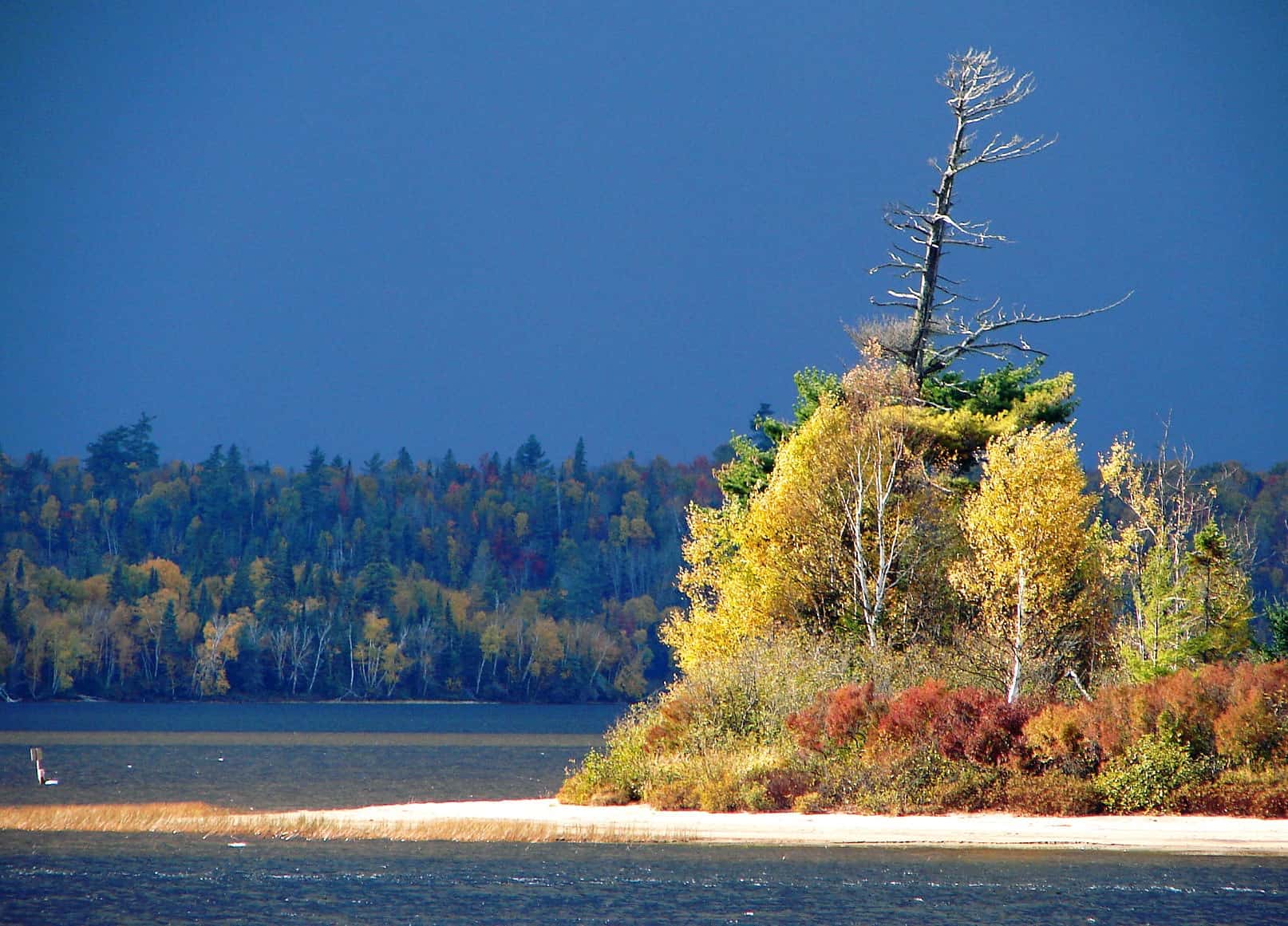
5. Petawawa – Pontiac Sand Plain
The massive sand deposits that characterize the landscape on both side of the river here were deposited when the Great Lakes drainage burst through ice dams into the upper Champlain Sea, forming a huge submarine delta. This may have been a cataclysmic event – occurring in days or weeks, not years – but regardless, it directly affected the nature of these lands for thousands of years thereafter. The vast pine forests that have characterized much of the Ottawa Valley are perhaps best expressed along the Petawawa – Pontiac sand plain. A remarkable diversity of provincially rare plants and animals are found throughout the sand barrens, dunes and forests of the pristine beach and coniferous woodlands of CFB Petawawa area, including such rarities as nationally significant Wood Turtle and (formerly) the only Canadian breeding population of the globally endangered Kirtland’s (Jack Pine) Warbler.
6. Petawawa Fish Hatchery
The steep sand bluff along the western side of the hatchery site is actually the abandoned shoreline of the much larger, post-glacial Ottawa River. From beneath the bluff and for kilometers to the north and south, ground water cleansed by millions of tonnes of clear sand forms numerous springs and seeps. These relict shoreline springhead conditions support a rich diversity of unusual species, some of which are typically western elements found rarely, if at all, elsewhere in eastern Ontario – western Quebec. The broad, emergent sand beaches of the Ottawa River here are also important feeding and resting sites for waterfowl that still follow ancient migratory routes up and down the river corridor.
7. Westmeath – Calumet White Water
Some would argue that this is the most spectacular and aesthetically appealing section of the entire Ottawa River, though that grand claim can be justifiably made by Ottawa River citizens at any number of personally favoured spots. This area certainly will figure high on any list of top sites, however. The river narrows and tumbles through a seemingly-endless series of torturous, rocky channels here. The awesome and intimidating rapids and falls that result from this rush of fast water generates kilometers of spectacular white water. The major rafting and kayaking eco-recreation industry that has developed in Ontario’s Ottawa River Provincial Park and adjacent Quebec-side river channels is completely dependent on the maintenance of high water quality standards and unmanaged natural river flow.
8. The Grove
Although manipulated for timber management purposes in the past, this urban woodland offers an excellent opportunity for Ottawa River citizens to experience a primary growth White Pine stand like those that once were a dominant habitat along Ottawa River shores and which constituted the first industrial product to be harvested here. The site also impressively demonstrates the power of citizen advocacy in the Ottawa Valley. With the important help of the Nature Conservancy of Canada, local citizens ensured that the site was purchased with private and public funds as a permanent natural reserve, thus sparing it from planned residential development.
9. Lac des Chats island and shores
Finally leaving the Canadian Shield landscape of the upper and middle Ottawa Valley, the river forms the broad Lac des Chats at its confluence with the Madawaska River. Although much has been lost to flooding behind the Lac des Chat dam, remaining shoreline areas on the mainland and numerous islands between Sandy Point in Renfrew County and Morris Island in the City of Ottawa are ecologically remarkable. One island and shore area of only a few hectares in size in Lavergne Bay, Morris Island, for example, is known to support several provincially rare and over a dozen regionally rare plant and animal species. Most of these special Lac des Chat elements are aquatic or shoreline species such as the Endangered Musk Turtle and provincially significant Map Turtle. They are dependent on the maintenance of natural conditions along these shores. Most significant of the habitats is the globally rare Shore Alvar vegetation. These bizarre natural meadows supporting many rare and even unique plant and animal species, are found on marble deposits on the Quebec shore and limestone bedrock on the Ontario side, have successfully endured millennia of natural flooding, ice scouring, fire and predation. Most examples, however, have been damaged or some eliminated by recent human activities.
10. Constance Bay Sand Hills and Shores
Fossilized Champlain Sea era dunes originally covered by a fire-dependent forest of Jack Pine, top the sand hills rising gently up from expansive beaches, supporting uncommon plants first reported here by Samuel de Champlain in the early 1600s. The emergent beaches support some of the largest known Canadian populations of a number of rare aquatic plant species. A long history of recreational and now permanent residential in the Sand Hills development has meant active, unnatural levels of fire suppression, severely degrading the diversity and population size of many of the uncommon and rare native upland plants and animals. This continuing build up of fuel (dead branches, old wood, etc.), threatens both residential and natural resources with an unnaturally intense and damaging fire one day.
11. Breckenridge Nature Reserve
Established in 2004 as a result of the active encouragement of the property owners, the Aldred family, this 270 ha Nature Conservancy of Canada reserve near Luskville protects one of the finest marsh habitat areas in the lower Ottawa River as well as ecologically valuable backshore habitats. These provide habitat for a wide variety of provincially and regionally rare flora and fauna. The Reserve provides an excellent example of a successful individual conservation initiative that was soundly based on scientific evaluations and which will provide permanent protection for significant Ottawa River shore habitats.
12. Innis Point – Shirleys Bay
This area protects what is likely the best example of globally rare Shore Alvar vegetation in the Ottawa Valley, as well as a remarkable diversity of riparian, swamp forest and marsh habitats. These include ancient, primary growth Red Maple swamps (the oldest such habitats in the Ottawa Valley ?), a long-established Wild Rice marsh and one of the most important migratory bird staging and feeding areas away from the Great Lakes in southern Ontario. It is also an important wintering area for raptors, including unusually large numbers of Great Gray Owls in some years (over 25 in 2005). Most of the site is managed by the Department of National Defence (Connaught Ranges) who have worked co-operatively with the City of Ottawa, the Ottawa Duck Club and others to successfully enhance wildlife populations and protect particularly significant habitats.
13. Eardley Escarpment
Although 5 to 6 kms away from the present shoreline, this bedrock escarpment forming the southern boundary of Gatineau Park is directly connected to the Ottawa River in various ways. Forming the shoreline in Champlain Sea times, its cliffs sustain relict populations of both northern and southern species that are well out of contemporary normal range, some of which are provincially and nationally rare. It also forms an important migration route for raptors migrating up and down the Ottawa River corridor. There is likely no better place from which to view and appreciate the two significantly different Ottawa River landscapes – the rugged Shield- based landscape to the north and the modulated, lowland-based landscape to the south – than from the spectacular vantage points along the Escarpment within Gatineau Park.
14. Britannia Conservation Area
This is the premier urban natural area of the Ottawa River watershed and one of the most significant such areas in Canada. Over 600 plant species and a remarkable diversity of natural habitats have been documented within its 100 ha area. On a national scale it is probably the National Capital region’s best known migratory bird observation location, with over 300 species observed, some of which are known from only a handful of records in Canada. If real estate value is determined by location, location and location, so too are migratory bird ‘oases’ like Britannia. It is situated at a constriction of the Ottawa River, surrounded by a sea of less suitable urban development. The conservation area is heavily used by naturalists and passive hikers alike, a fact recognized by the construction of low-impact recreational pathway in 2004 by the site’s manager, the National Capital Commission, which aids in the site’s long term protection.
15. Deschenes Rapids
Only one large rapids remains intact along the entire length of the Ottawa River without the negative impact of a bridge crossing, a hydro dam and/ or industrial development. The Deschenes Rapids descend rapidly down from Lac Deschenes across a sandstone sill, producing a broad, boiling white water area that is open and flowing year round. Not coincidentally, the rapids retain the only substantial Ottawa River population of the nationally rare Riverweed – once found commonly in other now-compromised fast water sections of the water course. This oxygenating ‘lungs-of-the-river’ also provide habitat for large numbers of wintering waterfowl as well as rare raptors (including Gyrfalcons in some winters) which prey upon them. These last natural Ottawa River rapids have been threatened with destruction by inter-provincial bridge and/ or industrial development for almost 100 years, protected from destruction on several occasions only by the diligence and actions of various private groups of Ottawa River citizens.
16. Lac Leamy Ecological Park
This is the meeting place between the Ottawa River and the Gatineau River, arguably its most important tributary. The magnificent primary growth maple swamps which have developed here support a wide variety of provincially rare plants and regionally rare animals. Like Britannia upstream, Lac Leamy is well situated to offer shelter and sustenance to migratory bird and in consequence, is likely the most popular birding site in the Outaouais.
17. Ottawa-Gatineau alluvial islands
Over the centuries river currents have deposited massive amounts of sand and silt in particular areas, first forming bars and eventually islands upon which flood dependent habitats have developed. A string of such virtually unique, constantly shifting creatures of the river have evolved with upstream Kettle Island being the largest and the Petrie Islands being most ecologically diverse. One of the flood-tolerant habitats that has established on these islands in the Hackberry – Ostrich Fern swamp, believed to occur nowhere else in Canada but the lower Ottawa and perhaps adjacent St. Lawrence River. Demanding site conditions have traditionally reduced but not eliminated development pressure on these aesthetically appealing sites and several are now in one form or another of protective status. All have negatively impacted, however, by head pond flooding from the Carillon Dam some 150 km downstream.
18. Greens Creek
The Champlain Sea laid down deep deposits of heavy, blueish clay upon which much of the rich farmland of southeastern Ontario and southwestern Quebec is situated. When cut into, however, this marine clay becomes highly unstable and slumps extensively. Such dynamic landscape actions are conspicuous along the steep, deeply incised slopes of Greens Creek. Curiously shaped clay nodules are found within such exposed deposits in and around Green Creek, especially near its confluence with the Ottawa River. Many of these have formed around a wide variety of plant and animal remains. These constitute a gold mine of information on the subarctic- boreal environment of the Champlain Sea and its environs. The steep, forested slopes of Greens Creek and the narrow clay-based flood plain provide an important wildlife corridor between the river and inland habitats to the south, across developed agricultural and urban lands. The creek also support a wide variety of provincially and regionally rare species, including probably the largest Canadian population of the rare Cat-tail Sedge.
19. Gatineau – Masson Marshes
A string of relatively narrow wetlands have developed along a 50 km stretch of the Gatineau and Papineau shores, the most important of these being Baie McLarin, Baie Clément and Baie de Lochaber. Together they form what probably constitutes the largest freshwater marsh complex in the Ottawa watershed and offer exceptionally important staging and feeding site for tens of thousands of migratory waterfowl each spring and fall. Breeding habitat for populations of nationally significant animal species such a Musk and Map Turtles and exceptional quality fish nursery conditions are also provided here. A coalition of governmental and non-governmental conservation and habitat protection groups has been successfully developing a program of habitat enhancement and public interpretation along these shoreline marshes in recent years.
20. Reserve faunique de Plaisance
Rather like the upstream alluvial islands, massive sediment deposits have been formed by the current into the river-shaped land mass of Grand and Petit Presqu’ îl, this one anchored to the shore by the peninsula extending out from the mouth of the Petit Nation tributary. Extensive marsh habitat in adjacent Baie Noire contributes many of the habitat attributes of the Gatineau – Masson marshes. The upland habitat of the Reserve, however, offer greater natural diversity and representation of both typical and rare lower Ottawa Valley flora and fauna than the marshes alone. An extensive system of trails and viewing facilities make this one of the best sites for public observation and appreciation of the remarkable natural diversity of the lower watershed.
21. Alfred Bog
It’s difficult to imagine such an immense area (4,000 ha) as being a capsule, but that’s what Alfred Bog is – a time capsule. Viewing to the horizon across this peat-based wetland south of Alfred is to see the subarctic landscape that dominated the lower watershed shortly after the Champlain Sea receded. The bog, like Mer Bleue its smaller, sister domed peatland in Ottawa, formed in an abandoned channel of the post-glacial Ottawa River and has remained virtually unchanged for 9,000 to 10,000 years. Aside from constituting an immensely important surface and ground water quality ‘facility’, the bog provides habitat for a wide variety of provincially and nationally rare plants and animals, offers wildlife corridor benefits for migratory animals, and offers a great number of scientific research opportunities concerning both particular features (e.g. Endangered Species) and broad environmental issues (e.g. global warming). Vankleek Hill and Ottawa naturalist successfully waged a decade long battle to stop the proposed destruction of the bog for agri-business purposes. Then working with the critical support and expertise of the Nature Conservancy of Canada, they raised the necessary private and governmental funds to purchase and preserve the bog. Protection and establishment of the Alfred Bog Reserve represents the largest single habitat conservation victory by private citizens in the Ottawa River watershed – to date.
< Previous post Next post >